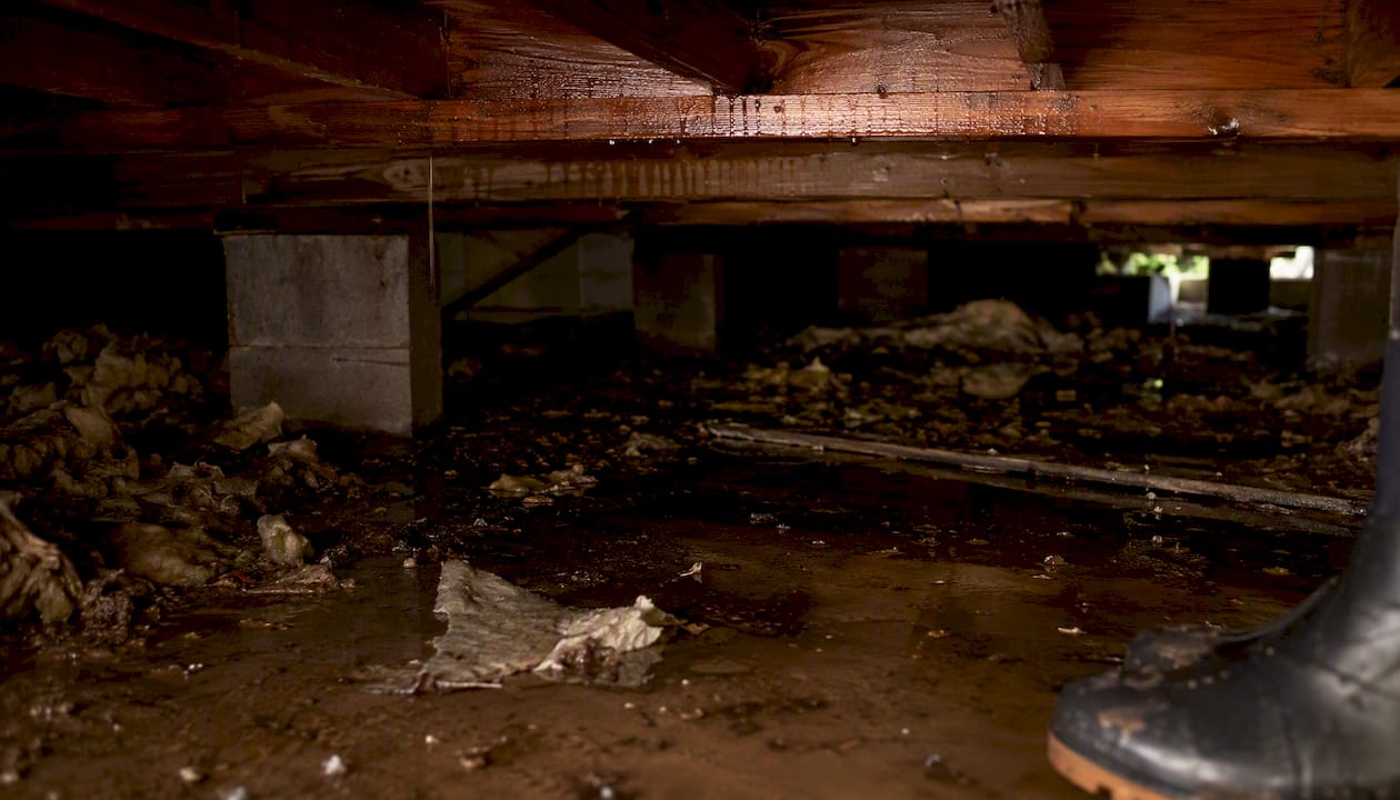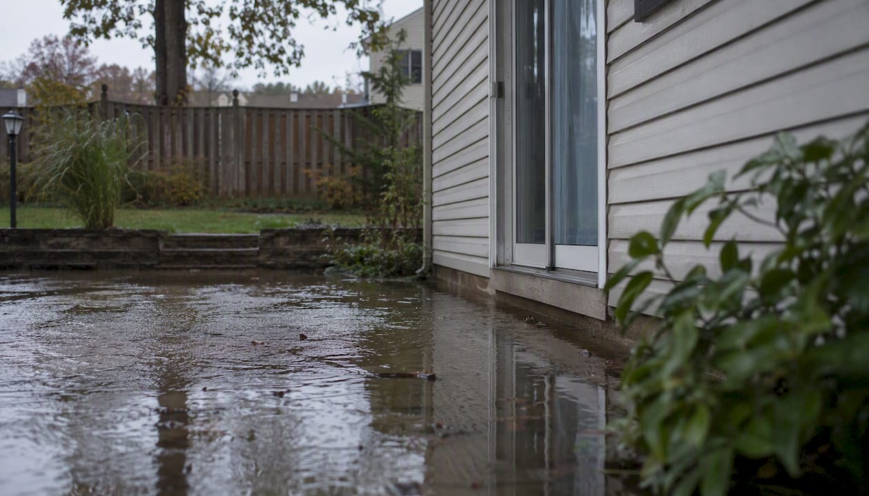

A floodplain is any low-lying land adjacent to a body of water that can be inundated during a flood event. For homeowners, that definition carries real financial weight: if your property sits inside a Special Flood Hazard Area (SFHA) as designated by FEMA, you may be legally required to carry flood insurance, face stricter building permits, and deal with resale complications that a standard home inspection will never flag.
Here is what that means in practical terms:
- Flood insurance may be mandatory. Properties in high-risk zones (those starting with A or V) with federally-backed mortgages require flood insurance through the National Flood Insurance Program (NFIP) or a private carrier.
- Your homeowners policy does not cover floods. Standard policies exclude flood damage entirely, so you need a separate policy regardless of zone.
- Flood designation affects buying, selling, and building. Lenders, appraisers, and buyers all factor zone status into their decisions.
- You can check your status right now. The FEMA Flood Map Service Center (MSC) lets you look up any U.S. address for free.
Next steps: pull your address on the FEMA MSC, review your mortgage documents for any insurance requirement, and read on to understand exactly what your zone label means.
Key Takeaways
A floodplain is any land subject to inundation by the base flood, and a 1% annual chance of flooding compounds to roughly a 26% probability over a 30-year mortgage.
| Point | Details |
|---|---|
| 1% annual risk adds up fast | A 30-year mortgage carries roughly a 26% chance of at least one base flood event. |
| Insurance is mandatory in SFHAs | Federally-backed mortgages in Zone A or V require flood insurance; standard homeowners policies exclude floods. |
| Verify your status with FEMA MSC | Use the FEMA Flood Map Service Center, FloodSmart, and Flood Factor to confirm your zone and 30-year risk. |
| Elevation certificates unlock savings | A licensed surveyor’s elevation certificate can support a LOMA petition and lower or eliminate your NFIP premium. |
| Call a pro after any significant flood | Contaminated water, standing water over 24 hours, or visible mold requires a certified restoration contractor, not a DIY cleanup. |
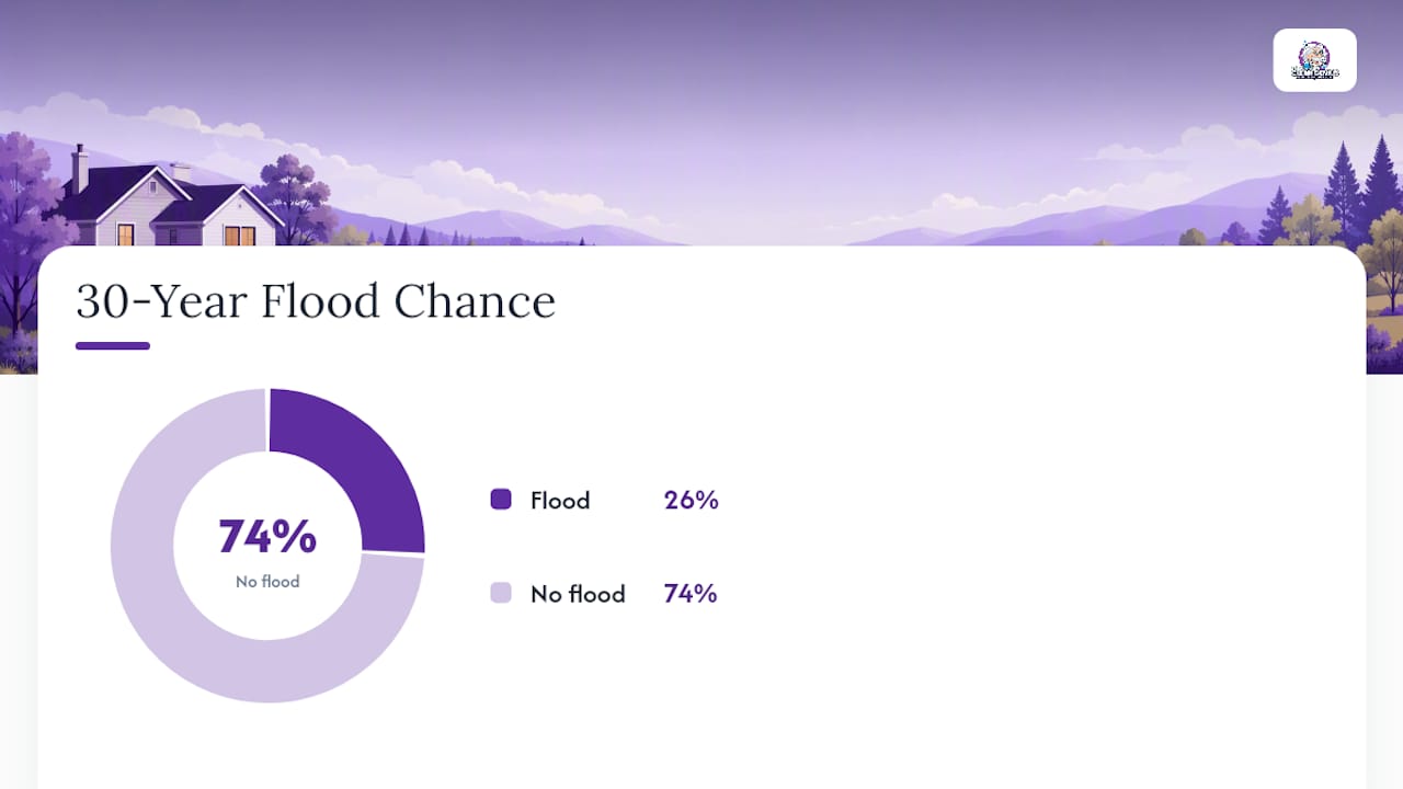
Table of Contents
- What does “100-year floodplain” actually mean for homeowners?
- How do FEMA flood zone labels translate into real risk?
- How FEMA makes flood maps and why your zone can change
- When is flood insurance required, and what are your options?
- How to check your property’s floodplain status, step by step
- What a floodplain designation means when you buy, build, or sell
- If flooding happens: immediate steps and when to call a pro
- How floodplain regulations affect remodeling and landscaping
- How climate change is shifting flood risk for homeowners
- A restoration professional’s perspective on flood risk
- Sources
What does “100-year floodplain” actually mean for homeowners?
The term “100-year flood” is one of the most misunderstood phrases in real estate. It does not mean a flood that happens once per century and then leaves you alone for another 99 years. It means a flood that has a 1% chance of occurring in any given year. That distinction matters because the math compounds.
Over the term of a typical 30-year mortgage, that 1% annual probability adds up to a substantial chance of experiencing at least one such flood. Think of it like rolling a die every year: each roll is independent, and the odds stack up faster than most buyers expect.
The land subject to that base flood is what FEMA calls the Special Flood Hazard Area. Any property inside the SFHA boundary on a Flood Insurance Rate Map (FIRM) carries that statistical exposure, whether the house has flooded before or not.
Two myths worth clearing up:
- “It already flooded recently, so we’re safe for a while.” False. Each year resets to 1%. A flood in 2023 does not reduce the odds in 2026.
- “We’re just outside the SFHA, so we have no risk.” Also false. FEMA itself emphasizes there is no zero-risk zone. Roughly 25% of NFIP flood claims come from properties outside high-risk zones.
How do FEMA flood zone labels translate into real risk?
FEMA assigns every parcel in the country a zone label based on its flood risk. Those labels range from high-risk SFHA designations to minimal-risk zones, and each one carries different insurance and building implications.
Zone AE is the most common high-risk designation you will see on a FIRM. The Base Flood Elevation (BFE) is printed directly on the map for AE zones, which is the number that drives your insurance premium calculation.
The floodway deserves special attention. It is the channel of a river plus the adjacent land needed to carry floodwaters without raising the flood level more than one foot. Building anything in a floodway, even a fence or fill dirt, typically requires a permit and an engineering analysis. Many communities prohibit new structures in floodways entirely.
How FEMA makes flood maps and why your zone can change
FEMA’s Flood Insurance Rate Maps are not static documents. They are built from hydrologic and hydraulic analyses, topographic surveys, river flow data, storm tides, and community-submitted information, and they get updated whenever new studies or significant land-use changes occur.
The Flood Insurance Study (FIS) is the technical report that accompanies each FIRM. It documents the methods, data sources, and assumptions behind the map. The BFE shown on your FIRM comes directly from that study.
Two terms every homeowner near a boundary should know:
LOMA (Letter of Map Amendment): If your property sits inside an SFHA but your ground elevation is actually above the BFE, you can petition FEMA to remove it from the high-risk zone. A licensed surveyor provides an elevation certificate showing your lowest adjacent grade, and FEMA reviews the data. A successful LOMA can eliminate your mandatory insurance requirement and lower your premiums significantly.
LOMR (Letter of Map Revision): Similar process, but applies to a broader area, often triggered by a community after a flood-control project or new engineering study.
Flood risk is also dynamic over time. Climate shifts, upstream development, and changes to drainage infrastructure can all push a property into a higher-risk zone on the next map update, even if nothing changed on your specific lot. Checking the FEMA MSC every few years is worth the five minutes it takes.
When is flood insurance required, and what are your options?
The mandatory purchase rule is straightforward: if your home is in an SFHA (Zone A or V) and your mortgage comes from a federally regulated or insured lender, you must carry flood insurance. No exceptions, no grace period after closing. Your lender will verify coverage at closing and annually thereafter.
Standard homeowners insurance excludes flood damage, which surprises a lot of buyers. A burst pipe is covered; a river overflowing its banks is not. That gap is why the NFIP exists.
NFIP vs. private flood insurance
The NFIP, administered by FEMA and marketed through FloodSmart.gov, is the most widely available option. It covers up to $250,000 for the building structure and up to $100,000 for contents. Private flood insurance policies can offer higher limits, broader coverage (including loss of use, which NFIP excludes), and sometimes lower premiums for lower-risk properties.
What drives your premium?
- Zone and elevation relative to BFE. A home one foot below BFE pays significantly more than one two feet above it.
- Distance to water and flood frequency. Proximity to rivers, lakes, or coastlines raises rates.
- Structure characteristics. Foundation type, number of floors, and whether utilities are elevated all factor in.
- Community Rating System (CRS) participation. If your municipality participates in FEMA’s CRS program, you may receive a discount of up to 45% on NFIP premiums based on the community’s flood management efforts.
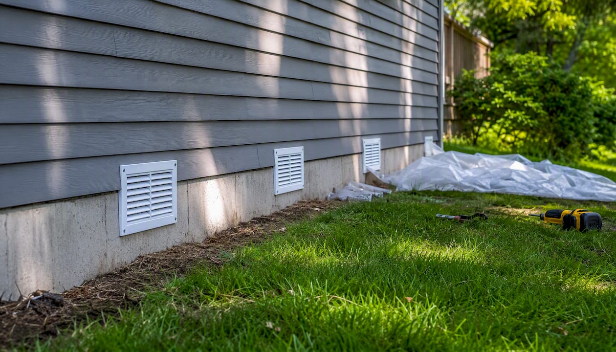
Mitigation steps that can reduce your premium include elevating the structure above BFE, installing flood vents in the foundation, and elevating mechanical systems (HVAC, water heater, electrical panel) above the base flood level.
How to check your property’s floodplain status, step by step
-
Go to the FEMA Flood Map Service Center. Enter your address at msc.fema.gov. The tool returns your current FIRM panel and zone designation. Download the FIRMette (a scaled map excerpt) for your records. Look for your zone label and, in AE zones, the BFE contour lines.
-
Cross-check with FloodSmart.gov and Flood Factor. FloodSmart is FEMA’s consumer-facing site and gives plain-language explanations of your zone plus NFIP cost estimates. Flood Factor, operated by the First Street Foundation, provides a 30-year risk score and historical loss data for individual addresses, which can reveal patterns the FIRM alone does not show.
-
Contact your local floodplain administrator. Every NFIP-participating community has one, usually housed in the planning or building department. They can tell you whether a LOMR has been filed recently, what local ordinances apply to your parcel, and whether any map amendments are pending.
-
Order an elevation certificate if needed. If your property is in or near an SFHA, an elevation certificate prepared by a licensed surveyor documents your structure’s elevation relative to BFE. It is required for NFIP rating in many zones and is the foundation document for a LOMA petition. Expect to pay a surveyor for this service; costs vary by location and complexity.
-
Request a LOMA if your elevation supports it. If the elevation certificate shows your lowest adjacent grade is at or above BFE, you have grounds to petition FEMA. A successful LOMA removes the mandatory insurance requirement for that property.
Pro Tip: Keep a copy of your elevation certificate with your closing documents. It transfers with the property and can save the next buyer hundreds of dollars per year in insurance premiums.
What a floodplain designation means when you buy, build, or sell
At the mortgage and closing table
Lenders with federally-backed loans will order a flood zone determination as part of underwriting. If the property falls in an SFHA, proof of flood insurance is required before closing. Ask the seller for their current elevation certificate and NFIP policy declarations page. Some sellers carry legacy NFIP rates that do not transfer to a new owner, so the premium you see on their policy may be far lower than what you will actually pay.
Buying in a flood zone can mean a lower purchase price, but the ongoing insurance cost and potential resale friction often offset that discount over a 10-year horizon. Run the numbers before assuming it is a deal.
The CFPB advises buyers to independently verify flood history and inspect for signs of past water damage, since seller disclosure requirements vary by state and do not always require full flood history. How prior flood damage was repaired matters as much as whether it happened. See also how water damage affects home value for a deeper look at resale implications.
Building and remodeling in a floodplain
Inside an SFHA but outside the floodway, you can typically build with permits and compliance requirements: the lowest floor must be at or above BFE, utilities must be elevated or flood-proofed, and flood vents are often required in enclosed foundation areas. Inside a floodway, the bar is much higher. Most communities require a no-rise certification from an engineer proving that any new construction will not increase flood levels upstream or downstream.
Landscaping is not exempt. Adding fill, grading the yard, or installing impervious surfaces can alter drainage patterns and may require a permit in regulated floodplain areas.
If flooding happens: immediate steps and when to call a pro
Safety comes first, every time.
- Evacuate if local authorities order it. Do not wait to see how high the water gets.
- Never enter water that may be electrified. Assume any standing water near electrical panels or outlets is dangerous until the utility confirms otherwise.
- Shut off gas and electricity at the main if you can do so safely and without entering flooded areas.
- Document everything before touching anything. Photos and video of every affected room, from multiple angles, before any cleanup begins. This documentation is the foundation of your insurance claim. A detailed guide on how to document water damage walks through exactly what insurers need.
- Move valuables and furniture above the water line if you can do so without entering contaminated water.
Call a licensed restoration contractor immediately when you encounter any of the following: sewage or black water contamination, structural damage (sagging floors, cracked foundations, shifted walls), standing water that has been present for more than 24 hours, visible mold growth, or damage to HVAC systems and electrical wiring. These are not DIY situations. Contaminated water carries pathogens; hidden moisture behind walls feeds mold within 24–48 hours of a flood event.
Pro Tip: Insist that any restoration contractor provide written moisture readings and a moisture map before and after drying. This documentation protects you during the insurance claim process and proves the job was completed to a measurable standard, not just “it looks dry.”
For emergency flood response in Chicagoland, a certified team with proper equipment and documentation protocols makes a measurable difference in both claim outcomes and long-term mold prevention.
How floodplain regulations affect remodeling and landscaping
Floodplain management regulations in the United States operate at three levels: federal (FEMA sets the minimum standards), state, and local. Communities that participate in the NFIP must adopt and enforce floodplain management ordinances that meet or exceed FEMA’s minimum requirements. Many go further.
For homeowners, the practical impact shows up in the permit office. Any substantial improvement to a structure in an SFHA, generally defined as a renovation costing 50% or more of the structure’s pre-improvement market value, triggers the same elevation requirements as new construction. That threshold is cumulative in many jurisdictions, meaning a series of smaller renovations can add up to a “substantial improvement” over time.
Landscaping rules are less uniform but equally real. Filling, grading, or adding impervious surfaces (driveways, patios, retaining walls) in a floodplain can redirect water onto neighboring properties and may require a floodplain development permit. Some communities also restrict vegetation removal along stream banks to preserve natural flood attenuation. Check with your local floodplain administrator before breaking ground on any project near a waterway or within a mapped SFHA.
How climate change is shifting flood risk for homeowners
Flood maps are built on historical data, but the climate driving that history is changing. Warmer air holds more moisture, which means heavier rainfall events. Sea levels are rising along coastlines. Urban development continues to replace permeable soil with concrete, accelerating runoff. The result is that properties mapped as moderate-risk today may face conditions that look more like high-risk zones within a 20-to-30-year mortgage term.
FEMA’s Risk Rating 2.0, the updated pricing methodology the NFIP began using in 2021, attempts to reflect this by pricing individual property risk more precisely rather than relying solely on zone labels. Some homeowners in Zone X saw their premiums increase under the new system because their actual risk was higher than their zone suggested.
The practical implication: do not treat your current zone label as a permanent verdict. Check Flood Factor’s 30-year risk projection for your address, which incorporates climate modeling alongside historical data. If the projection shows meaningful risk increases, factor that into your insurance decisions now rather than waiting for a map update to force the issue.
A restoration professional’s perspective on flood risk
Most homeowners I talk to in Chicagoland are surprised to learn their property’s flood risk until water is already in the basement. By then, the conversation shifts from prevention to damage control. The gap between “we’re not in a flood zone” and “we have two inches of standing water” is often just one heavy rainfall event or a backed-up storm drain.
What I have seen repeatedly is that the homeowners who fare best after a flood are the ones who documented their property’s condition before it happened, understood their insurance coverage in advance, and called a certified restoration team before attempting cleanup themselves. Hidden moisture is the real enemy. Water that looks gone after a shop-vac pass is often still sitting inside wall cavities, under flooring, and in insulation, feeding mold that shows up six weeks later.
If you are in Chicagoland and flooding has already reached your home, or you want a professional assessment of your property’s vulnerability, Thecleangenius offers 24/7 emergency water damage restoration with direct insurance coordination and certified moisture documentation on every job.

Flooding doesn’t wait for business hours. Thecleangenius serves Chicagoland 24/7 with certified water damage restoration, moisture mapping, and direct insurance coordination. From Arlington Heights to Naperville and everywhere in between, our team responds fast and documents everything your claim needs. Start your claim checklist or call us now.
Sources
- FloodSmart — What is my flood zone?
- FEMA — Flood maps
- FEMA — How to read a Flood Insurance Rate Map (FIRM) / MSC tutorial
- Realtor
- Consumer Financial Protection Bureau — What questions should I ask about flood and disaster risk when buying a house?
This article is general information, not a substitute for advice from a qualified financial advisor. Consult a qualified financial professional about your own circumstances before acting on anything here.